
New eco-trail: Parangalitsa Nature Reserve, Rila National Park, Bulgaria

The Rila National Park Directorate, in the context of the BIO2CARE project, completed a new trail in the nature, the PARANGALITSA ECO TRAIL, which was designed so that it can also be visited by persons with disabilities.
This new trail attracts various categories of visitors, from nature lovers and student hikers, to residents of the surrounding area who are looking for a little exercise and contact with nature.
The trail is located in the area of Prangalitsa and is offered for the observation of the flora and fauna of the Rila National Park.
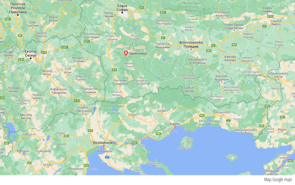
Part of an existing eco trail in Parangalitsa is to be reconstructed to ensure accessibility for persons with disabilities (30 km from Blagoevgrad, 130 km from Sofia, 225 km from Thessaloniki and 280 km from Nestos-Keramoti)
The trail is managed by the Rila National Park Directorate and its new Visitor Centre in Blagoevgrad.
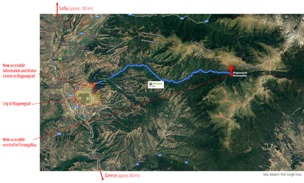
The eco trail in Parangalitsa is 30 km away from the new Visitors Information Center of the park in Blagoevgrad
The PARANGALITSA ECO TRAIL is just 30 Km away from the center of Blagoevgrad, heading a northeast direction, and about half kilometer after the Kartala Ski Resort[1].
When approaching the area, the visitors first encounter a welcome / bird watching area with picnic tables, chemical WC, etc. Around this area the visitors may leave their cars (note: there are no marked spaces for parking) and continue on foot.
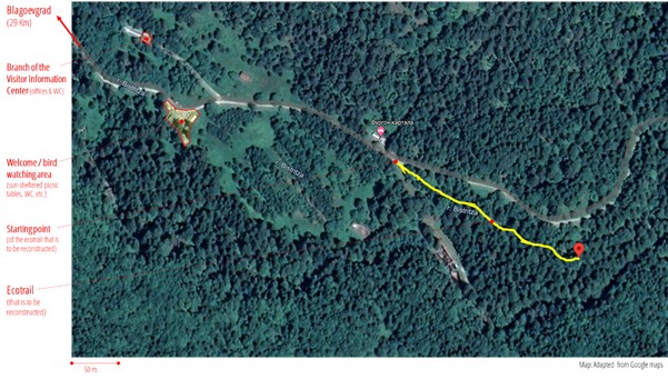
Before reaching the reconstructed part of the eco trail in Parangalitsa, the visitors first encounter a welcome / bird watching area with picnic tables, chemical WC, etc.
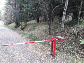
After around 170 m, and after getting around a vehicle road closure gate, the visitor will meet at the left hand side a refuge/guest house Фургон картала, and right after, just 30 m away, on the right hand side, the entrance of the new eco trail[2] (42°2'28"N 23°22'10"E).
After getting around a vehicle road closure gate the visitors meet on their right the entrance/starting point of the new eco-trail.
The improved part of the trail has a length of 200 m. After that, the path continues deeper into the protected area, but it gets more and more difficult and inaccessible. Therefore, wheelchair users or blind visitors, for instance, are suggested at the end of the improved part to make a turn and head back to the entrance/exit, this completing in total a distance of around 400 m.
On the way back, and after exiting the new eco-trail, at about 150 m, the visitor can turn left and then reach, after another 100 m, reach a building which belongs to the Bulgarian Academy for Research and which hosts some of the offices/services of the Rila National Park Directorate, thus acting in a way as branch of the Blagoevgrad Visitor Information Center.
Now, after the interventions and the smoothing of the TRAIL that took place in the context of the BIO2CARE Project, the path is relatively gentle, without irregularities, with almost zero transverse slopes and slight slopes locally along the direction of path as it is uphill.
The route, before its final configurations, showed a total gain / loss of the order of 22.8 m. / -7.41 m. With average slopes of 11.1% / -8.1%, with a local maximum of 25.3% and a minimum of -40% (According to data from Google Earth). Essentially, these are small fluctuations, since the altitude along the route only varies between 1,484 m. and 1,500 m. (difference 16 m.).
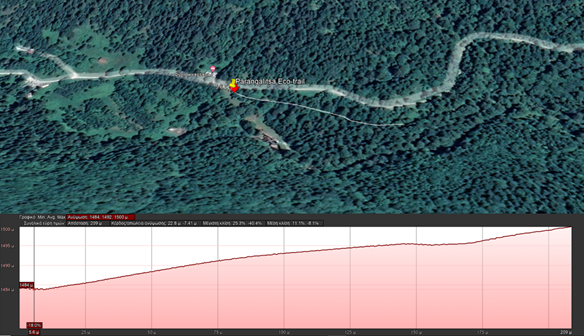
Elevation map of the trail.
Now, after the interventions and the smoothing of the trail, the path is quite gentle, has a straight, relatively hard surface, without major irregularities and with minor transverse slopes as well as minor longitudinal slopes locally along the direction of movement.

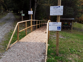
The accessible path starts at the new constructed bridge, where visitors can temporarily park for debarkation.
By the entrance there is signage available also in Braille.
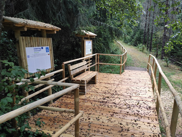 The bridge leads to a platform with a rest bench and additional informative signs in English, Bulgarian and Braille.
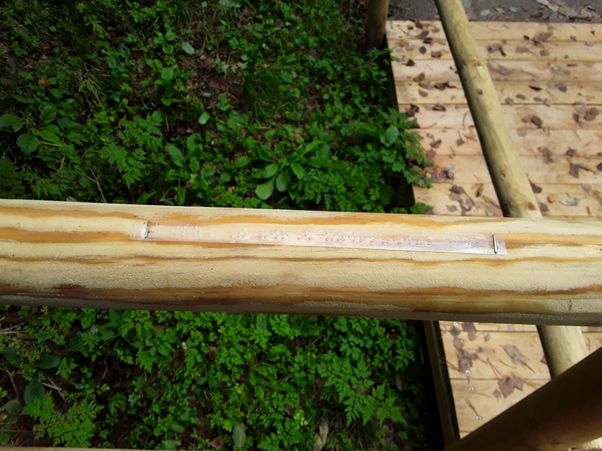
The handrailing in place serves also as a guide for blind visitors and incorporates labels printed in Braille with notifications for turn, points of interest, etc.
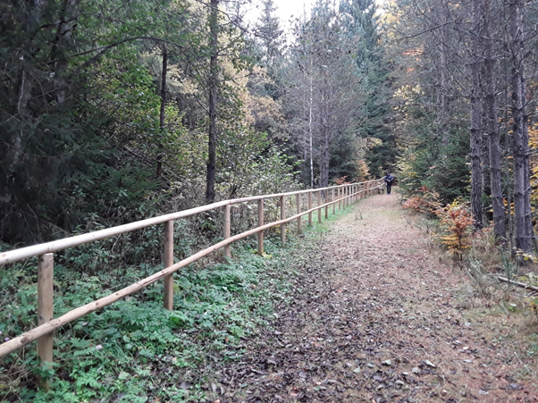
The path in general is 2.0 to 2.5 m wide with handrails on the one side.
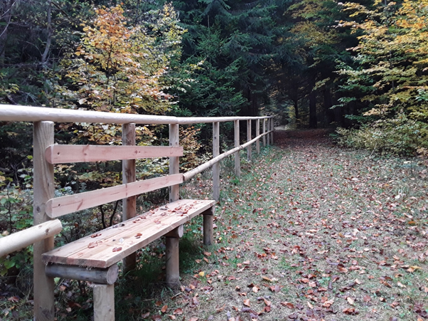
Every 35 to 40 m. there are rest benches in place.
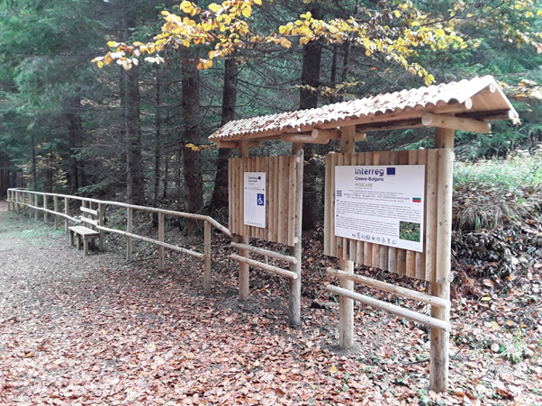
Along the trail there are additional signs with information about flora and fauna (available in English, Bulgarian and Braille).
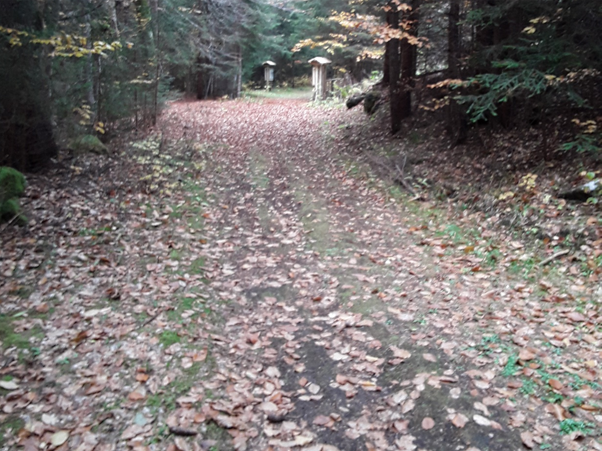
After 200 m. the old path continues without special landscaping being made or provisions for disabled visitors.
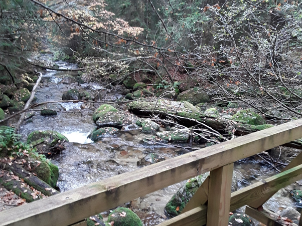
The old path leads, after 100-150 m. to two beautiful bridges that offer view to the river.
It is allowed to visit the trail with guide dogs and / or help dogs.
The trail can be visited all year round, however the access conditions can change dramatically in cases of strong winds, rain, snowfall, frost, etc., so it is recommended not to visit the trail under such conditions.
Guests can be informed about the accessibility and the conditions of the route prior their arrival at the Visitors Information Center in Blagoevgrad.
Accessibility inspection
See attached the "Accessibility Statement", which was prepared on 14.12.2020, following an evaluation carried out by DOMI ANATYXIS IKE and EUROPRAXIS M.ΙΚΕ, on behalf of the National Confederation of Persons with Disabilities (ESAmeA), based on a systematic control of compliance with the Guidelines for the "Guidebook for Accessible Nature Trails - Design Guidelines and Evaluation System".
[1] A 2-star hotel that provides ski-to-door access with 3 lifts and accommodation with a restaurant, free private parking, a bar and a garden.
[2] Small vans carrying wheelchair users or small groups with mobility issues may reach this point and allow passengers to disembark right at the entrance of the path.
Attachments
More images


