
New eco-trail: Kotza-Orman forest (Keramoti), National Park of Eastern Macedonia-Thrace, Greece

Introduction
The Municipality of Nestos, in the context of the BIO2CARE Project, created a new eco trail, the KOTZA-ORMAN FOREST ECO TRAIL, which was designed in order to accomodate also the needs of visitors with disabilities.
This new trail attracts various categories of visitors, from nature lovers and student hikers, to residents of the surrounding area who are looking for a little exercise and contact with nature.
The trail is located in the area of the Municipal Department of Keramoti and is offered for the observation of the flora and fauna of the National Park of Eastern Macedonia-Thrace. It is directly connected to the operation of the Delta Nestos Information Center operated in Keramoti by the Managment Agency of Nestos Delta - Bistonida - Ismarida and Thassos.
The route is circular, with a total length of 650 m. And is characterized as "EASY". The route starts from the Nestos Delta Information Center and extends northeast through the adjacent forest.
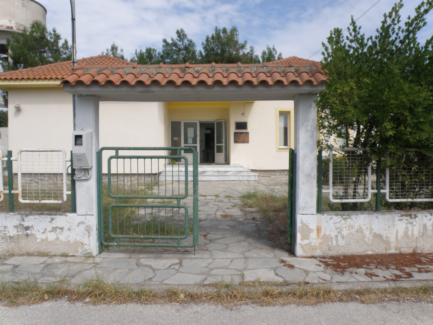
Photo: Nestos Delta Information Center
About the Information Center
Together with the Agency's second Information Center in Porto Lagos (Information Center of Lake Vistonida-Ismarida), the staff of the Agency provides information on protected areas, suggested routes (by car, bike or on foot) and guided tours for bird watching in the National Park of Eastern Macedonia-Thrace which includes the protected areas of the Nestos Delta and the lakes Vistonida and Ismarida with a total area of 930,000 hectares.
The Nestos Delta Information Center is located at the eastern end of the Municipality of Keramoti, just 15 km from Chrysoupoli (capital of the Municipality) and 40 km from Kavala (capital of the Regional Unit), and is housed in a relatively newly built ground floor building, with a specially designed courtyard space that gives access to people with mobility limitations. The access to the Center is easy, either by private car or by the intercity buses KTEL of the prefecture of Kavala (about ten minutes walk from the center of Keramoti - Port).
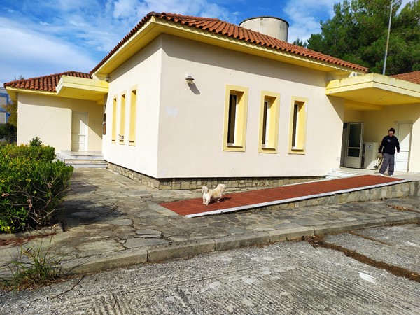
Photo: Ramp access to the Information Center
At the Information Center, the visitor has the opportunity through a variety of approaches to understand the structure, function and values of the habitats of the Delta Nestos. The Center also includes a photo exhibition which is developed in six thematic sections, with informative texts and rich photographic material. The exhibition space is supported by a screening room, with a capacity of 30 people, giving visitors the opportunity to watch various presentations and films about the Delta Nestos area.
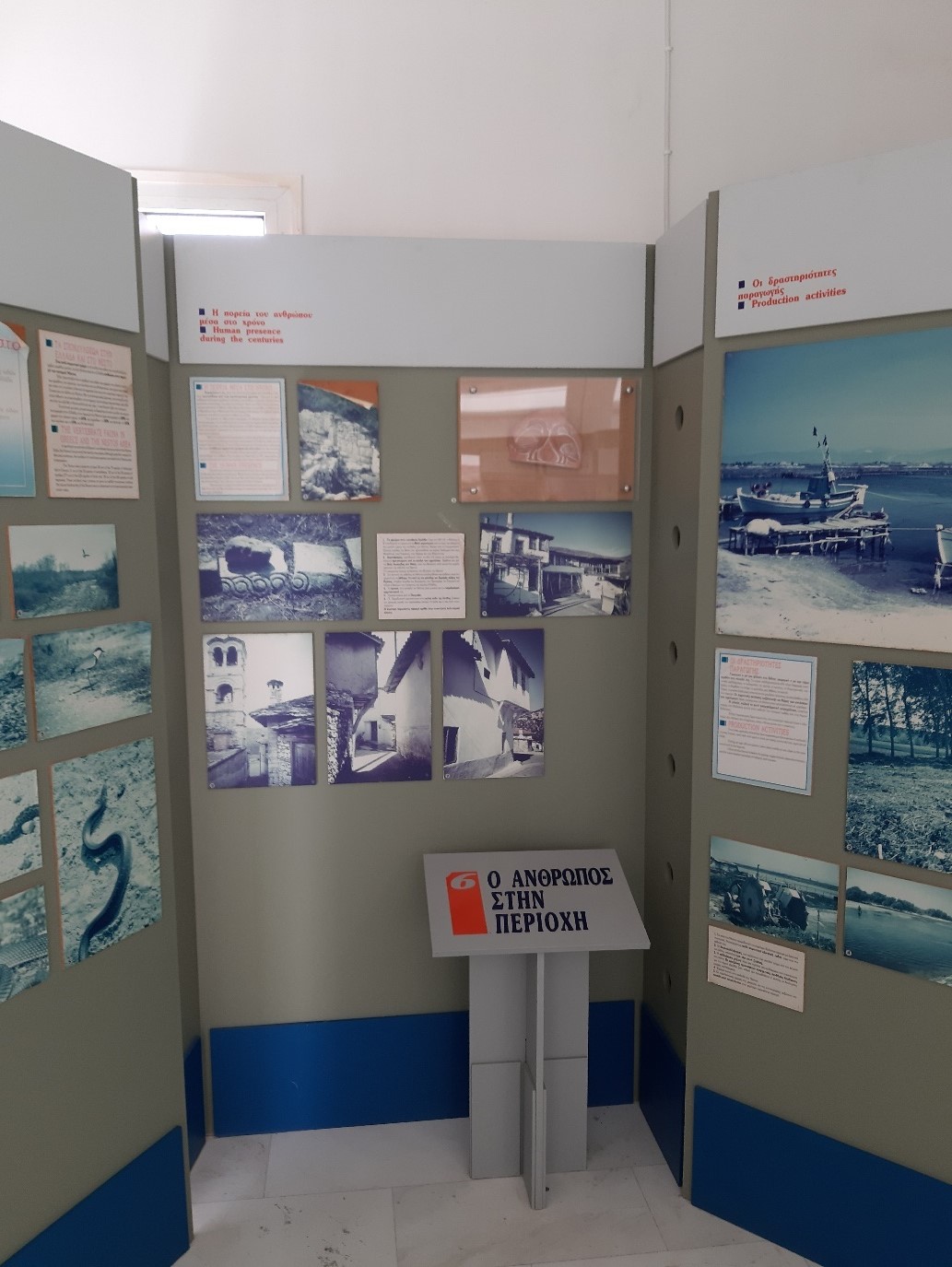
Photo: Photographic exhibition at the Information Center
Accessibility at the building of the Information Center
Outside
- Sidewalk width 1.1 m, 8-9 cm kennel (outside)
- Parking sign at 1.55 m height
Meeting room
- Movable furniture
- Free height 75cm on the tables, Depth 55cm, Length> 80cm.
- Corridors longer than 1.5m. if the chairs are removed
Other areas
- Corridor next to a pedestal 82cm.
- Space in front of a pedestal 1m.
- Computer at 95cm, Blank for feet 58cm. width, 60cm. height
- Height of space entrance 2.12m.
- The WC is not accessible
About the forest
The KOTZA-ORMAN forest:
- It is a self-sustaining riparian forest
- Maintains small freshwater wetlands
- Many birds, mammals, amphibians and reptiles nest and feed inside
- From the point of view one can easily admire birds that either live in the lagoon or visit it periodically
-
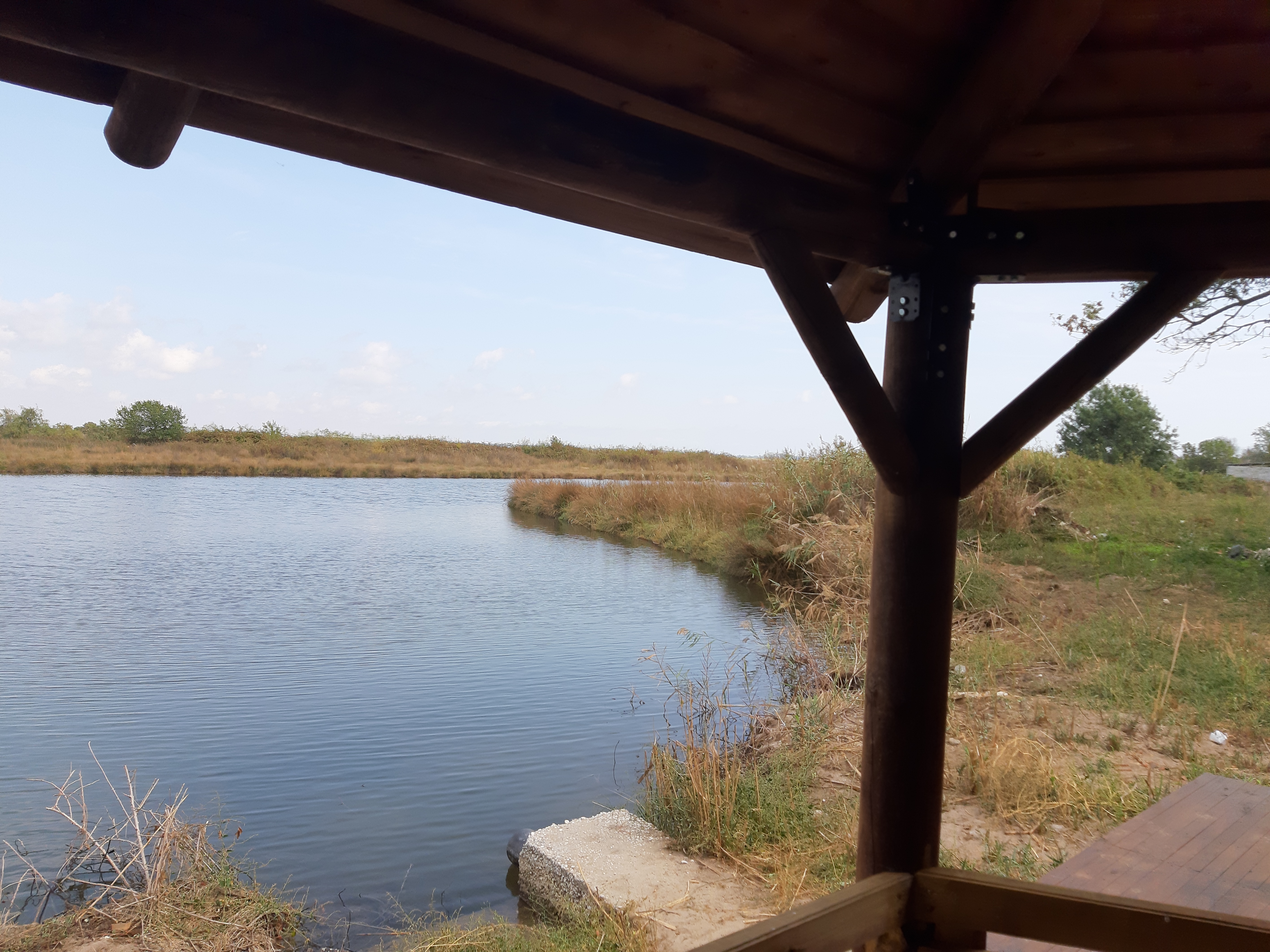
Photos: View/observation point
About the trail
The Municipality of Nestos in collaboration with the Agency, designed the trail in question, which is circular, i.e. begins and ends at the same point, just by the Center. Thus, the Agency now has the opportunity to provide a more complete experience to its visitors (e.g., in schools, groups of the elderly, people with disabilities, etc.), which combines a visit to the Center's facilities, the information and multimedia promotion with direct contact with nature through eco-tour on the new route which is of great environmental interest.
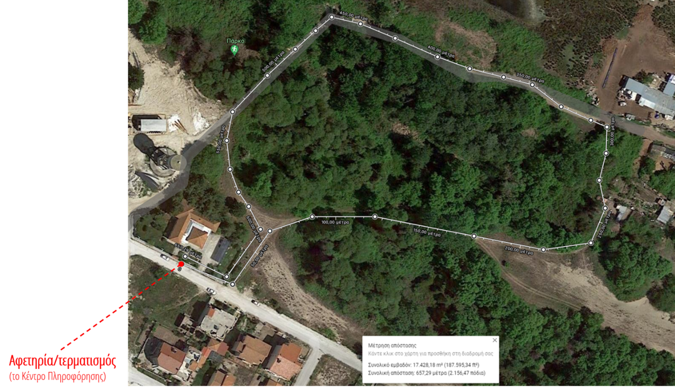
Image: Route overview (from aerial view)
As mentioned above, the trail starts from the Information Center and extends northeast through the adjacent forest with a total length of about 650 meters. The trail, before its final configurations, showed a total gain/loss of height of +/- 15 m. With average slopes of +/- 3.8%, with a local maximum of 21.4% and a minimum of -14.3% (according to data from Google Earth). Essentially, these are very small fluctuations, since the altitude along the route varies between 1 and 4 m at most.
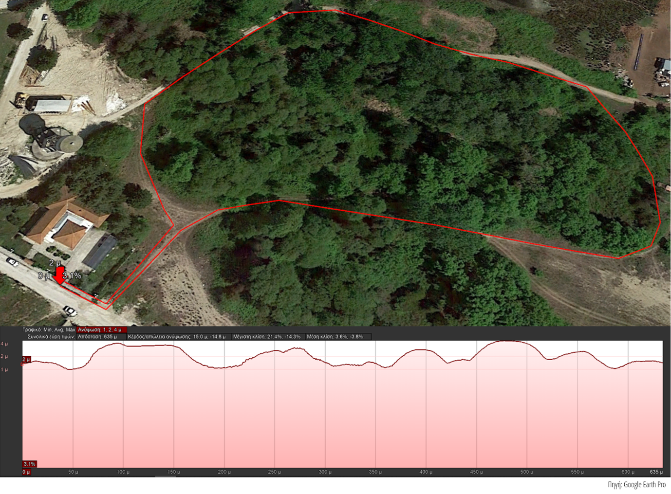
Image: Route Elevation Map (before the Project's interventions)
Now, after the interventions and the smoothing of the trail, the path is completely gentle, has a straight, hard surface, without irregularities and with almost zero transverse slopes as well as minimal slopes locally along the direction of movement.
The train now includes:
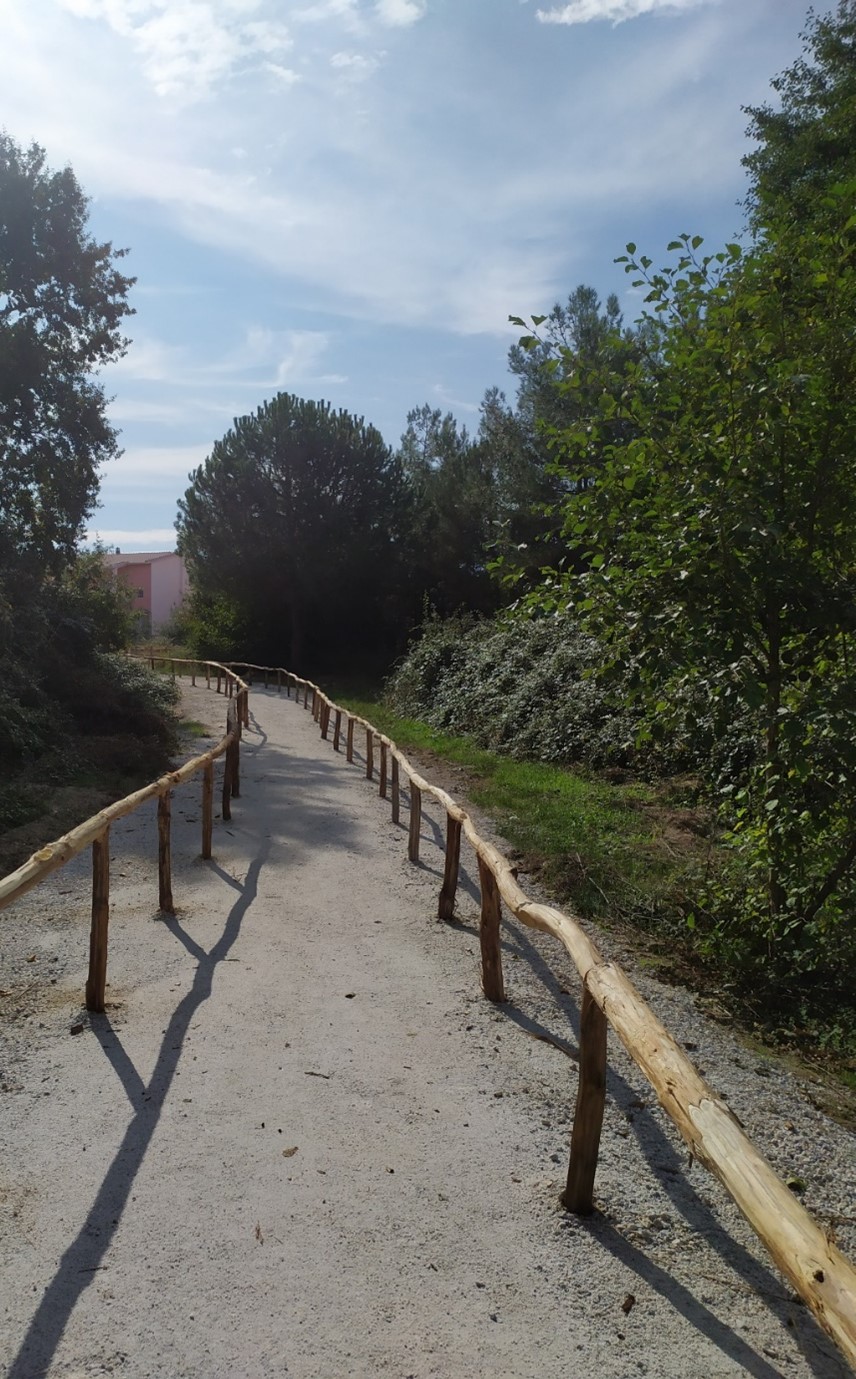
Photo: Path of clear width 1.5m. and above (allows wheelchair users to rotate)
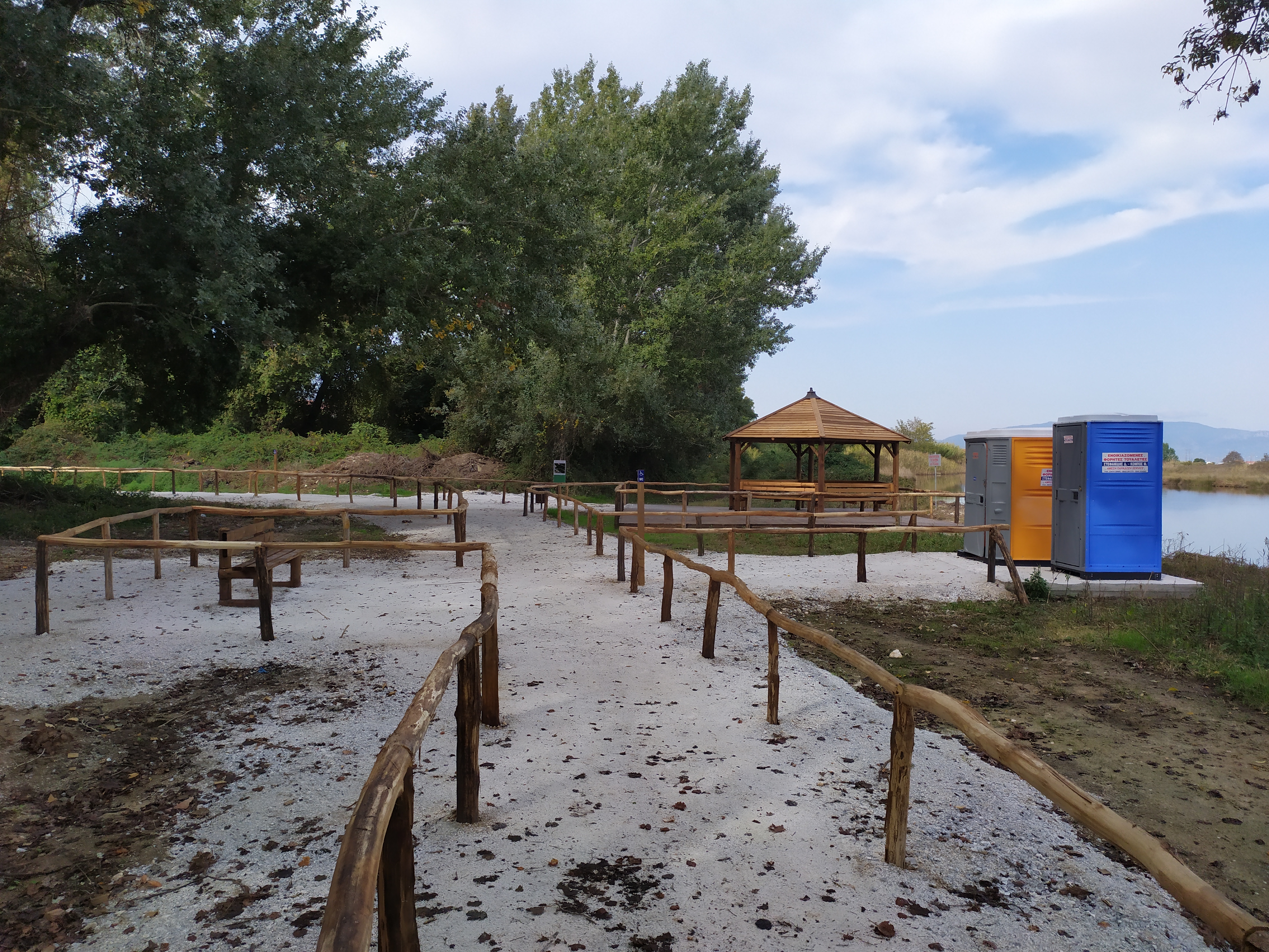
Photo: Slope of the route <= 2% (facilitation of visitors with reduced mobility) - Soil compaction that creates a solid traffic surface (facilitation of visitors with reduced mobility and especially wheelchair users)
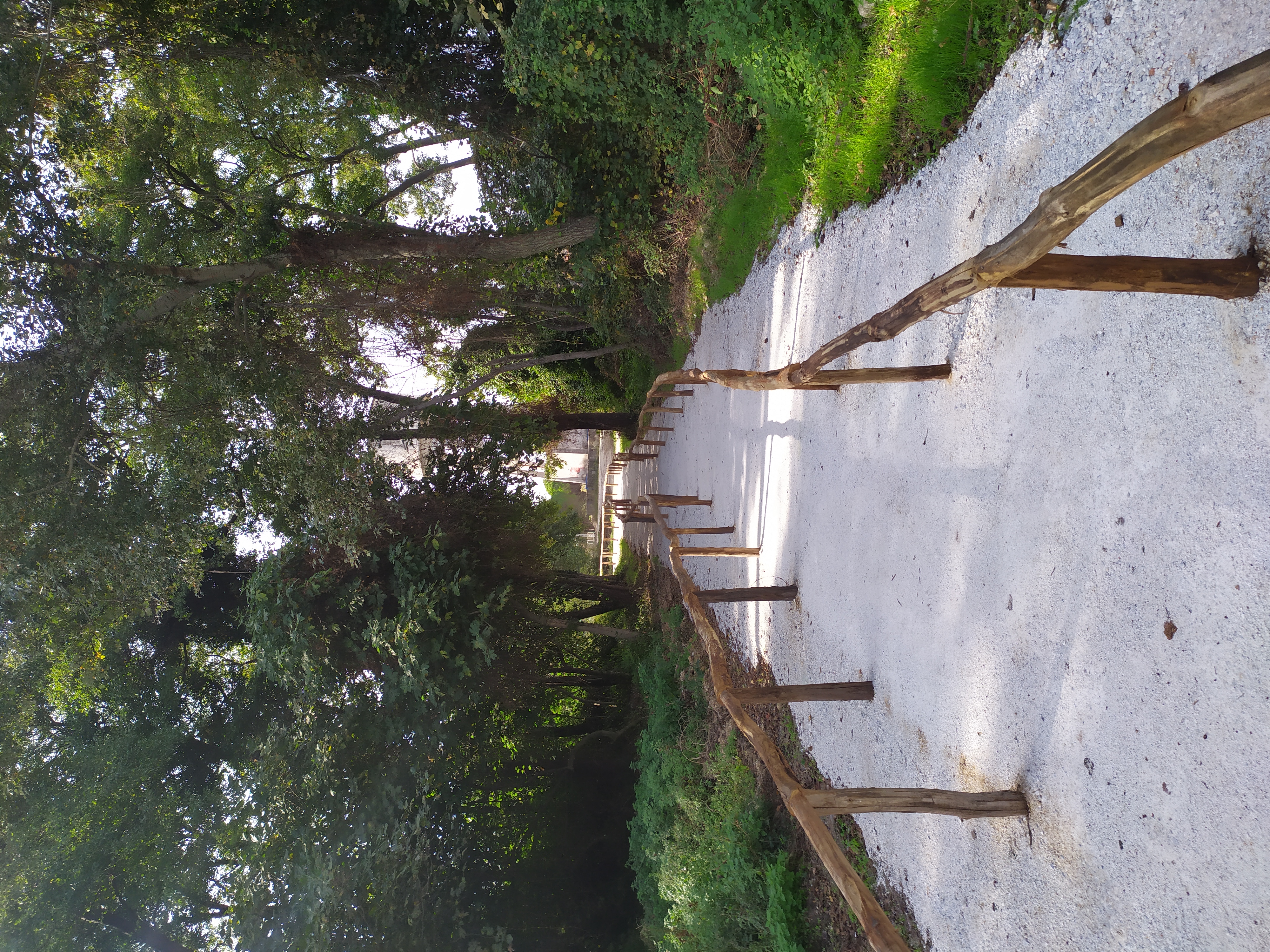
Photo: Path of clear height 2.3m. and above (free of trees / branches)
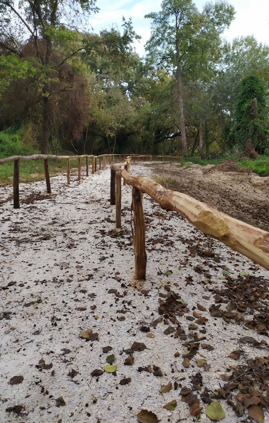
Photo: Fences-Handrails in two heights. On the one hand at a height of 90 cm, to function as a guide handrail for blind people and as an auxiliary handle for people with limited vision and people with reduced mobility. On the other hand at a height of 75 cm, to function as an auxiliary handle for people with wheelchairs.
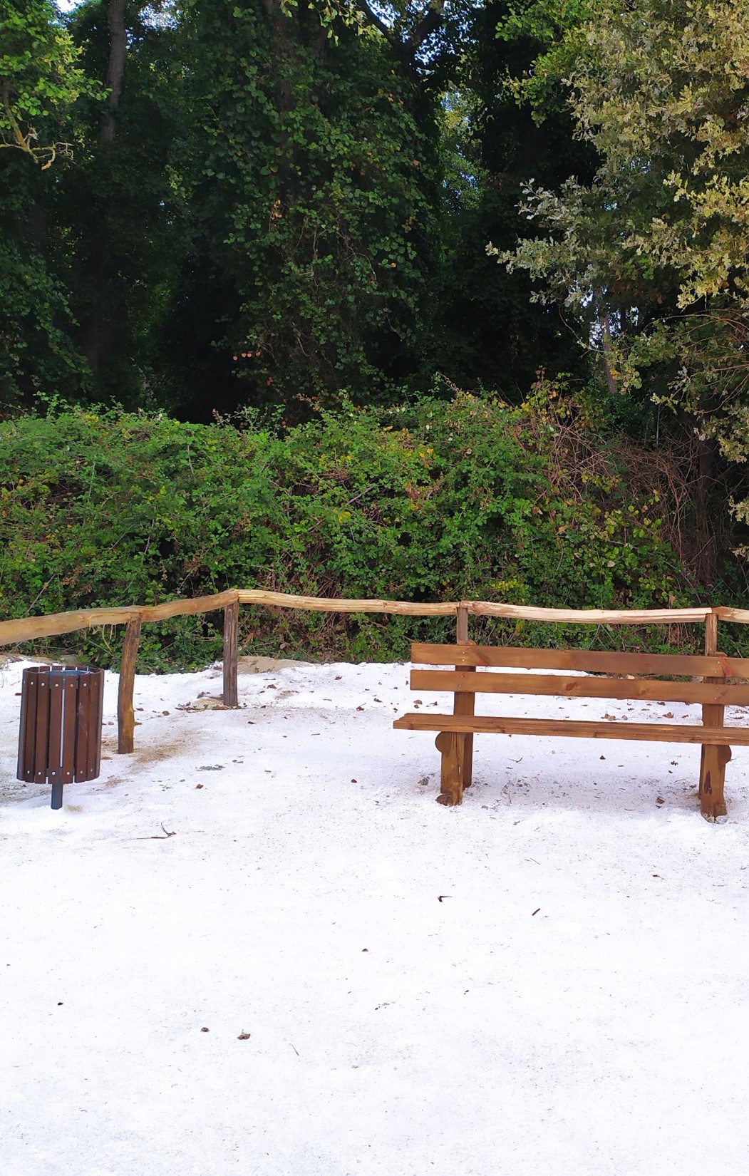
Photo: Widening to create six (6) rest/pause points along the route (every 70-90m.). With wooden seats and extra space on the sides for wheelchair parking. Equipment (e.g. trash cans) at a height suitable for wheelchair users.
Photo: View / observation point (kiosk): platform accessible to wheelchair users with covered space (kiosk), at the point where the path meets the river. Wheelchair accessible.
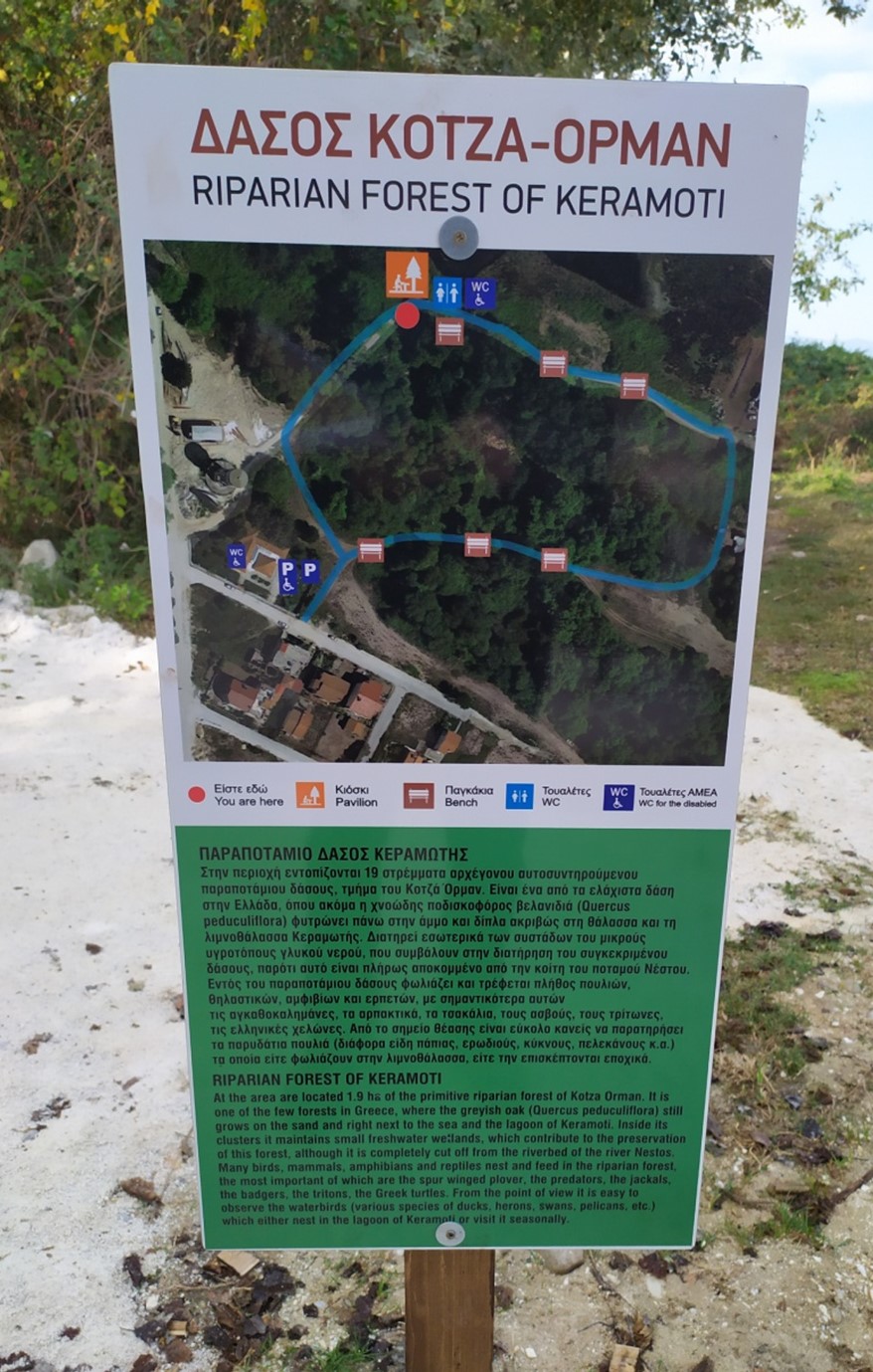
Photo: Information marking at the point of view / observation. Information sign with information about the riparian forest of Keramoti.
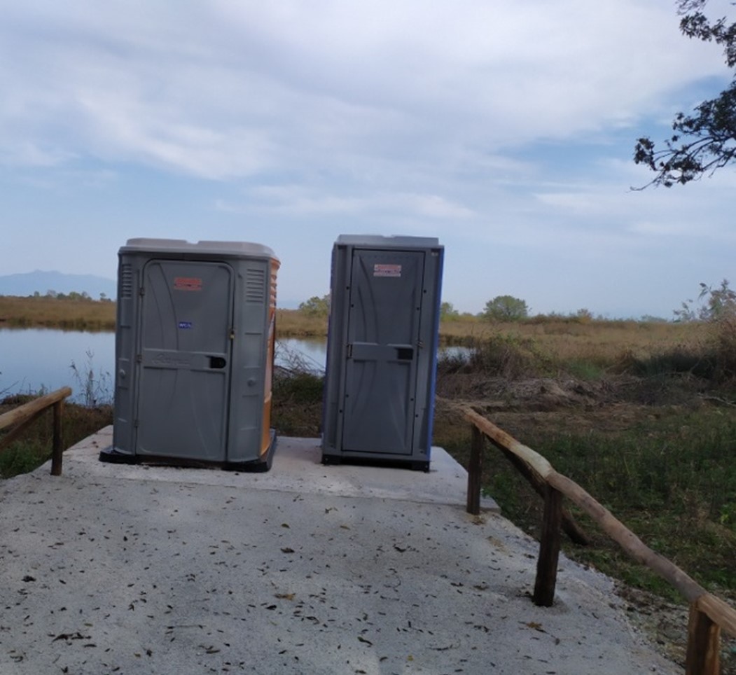
Photo: Two toilets (portable cabins), one conventional and one disabled, close to the viewing / observation point.
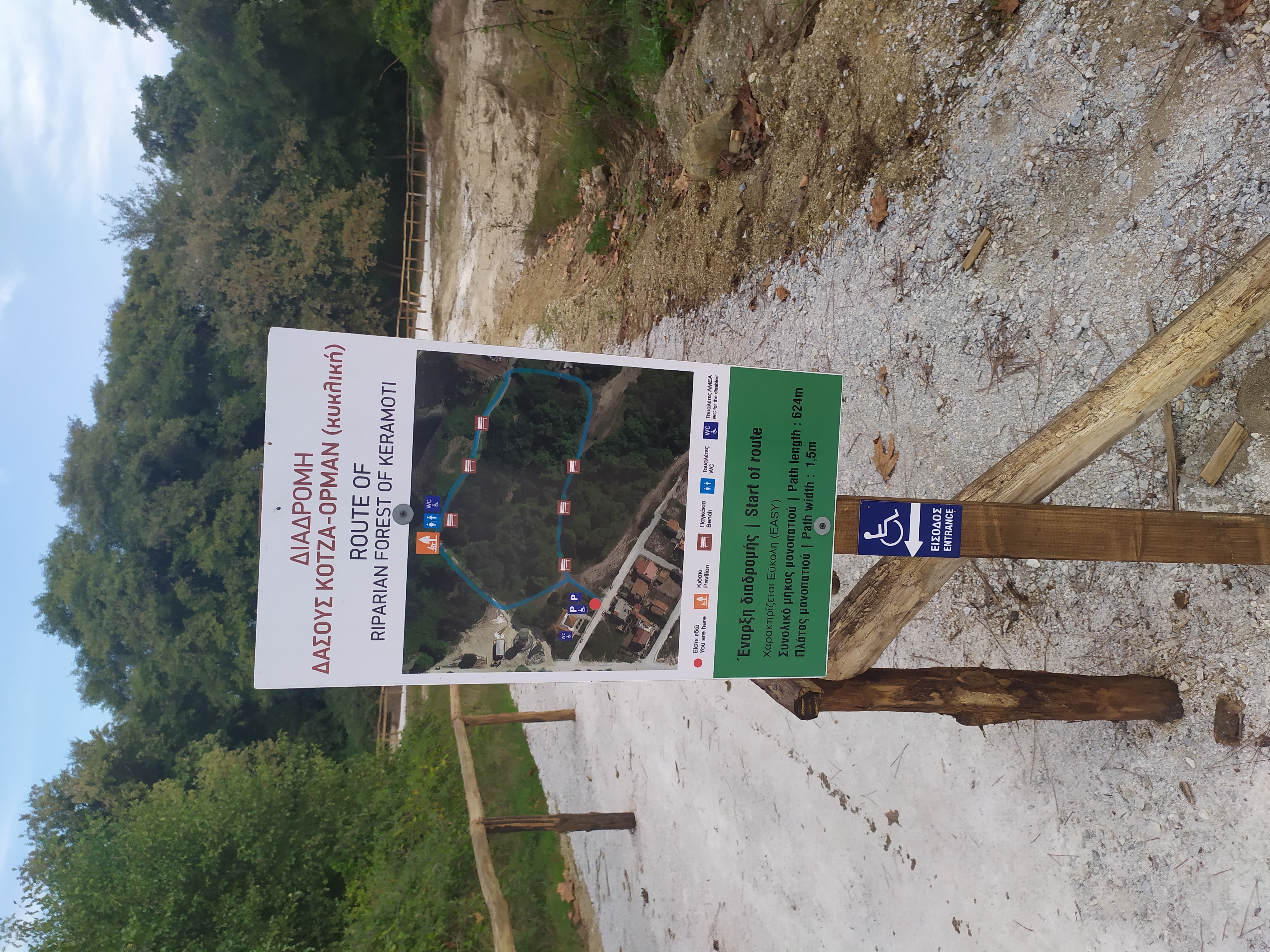
Photo: Entrance-exit marking, with the name of the route, the indication "Start / End of the trail", its characterization ("EASY-EASY"), the total length, the width of the path, with pictograms & international signs of accessibility (accessible entrance) and with a route map with points of interest (Information Center, view point, etc.), rest stations, public / disabled toilets, etc.
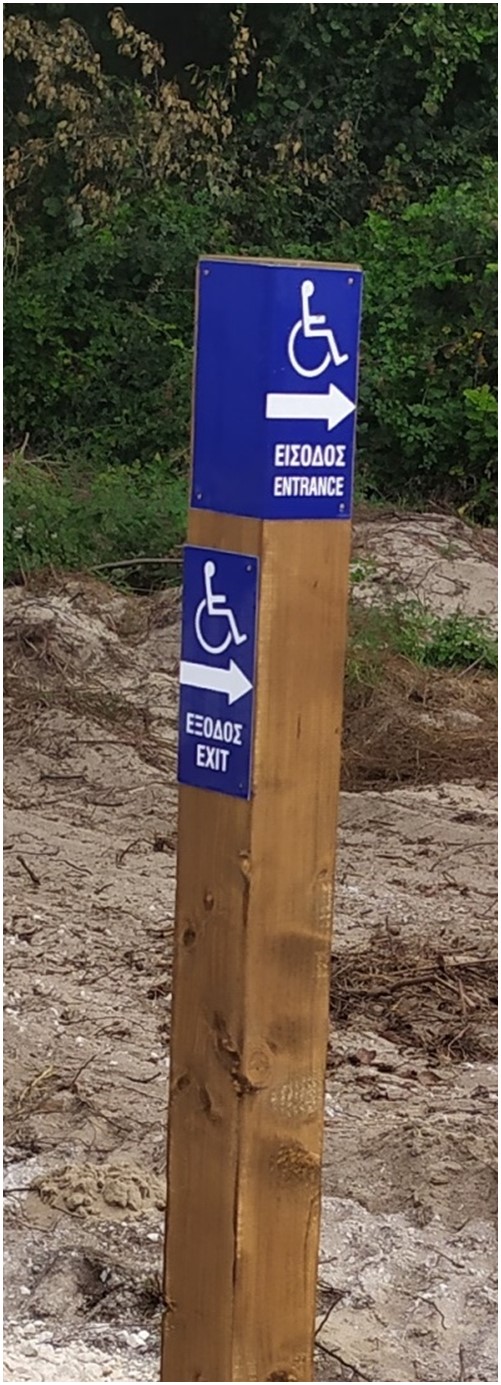
Photo: Direction marking for orientation to accessible paths and facilities.
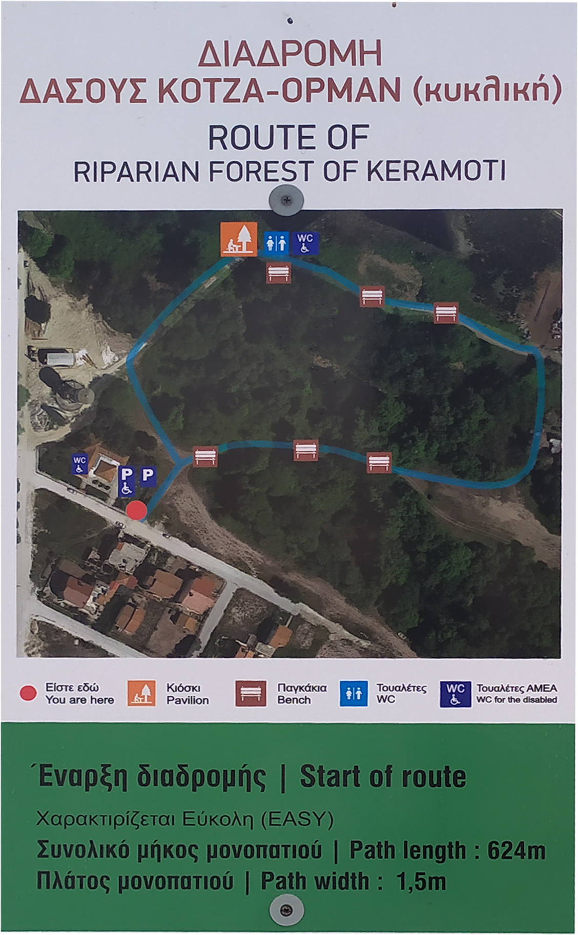
Image: Map of the trail.
It is allowed to visit the trail with guide dogs and / or help dogs.
The trailcan be visited all year round, however the access conditions can change dramatically in cases of strong winds, rain, snowfall, frost, etc., so it is recommended not to visit the trail under such conditions.
Guests can be informed about the accessibility and the conditions of the route upon arrival by the staff of the Nestos Delta Information Center.
Accessibility Assessment-Declaration
See attached the "Accessibility Statment", which was prepared on 14.12.2020, following an evaluation carried out by DOMI ANAPTYXIS IKE and EUROPRAXIS μΙΚΕ, on behalf of the National Confederation of Persons with Disabilities (ESAmeA), based on a systematic control of compliance with the Guidelines for the "Guidebook for Accessible Nature Trails - Design Guidelines and Evaluation System".
Attachments
More images


